GEFIS Gewerbeflächen-Informationssystem
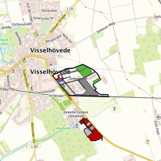
Celler Straße Ost (Flurstück 20/21) at Visselhövede, Landkreis Rotenburg (Wümme)
Legend
Availabilities
Immediately
short term (2 years)
medium term (2-5 years)
long-term (> 5 years)
optional area (bindingly reserved)
occupational pension plan
not available
Brief description
Description of the parcel
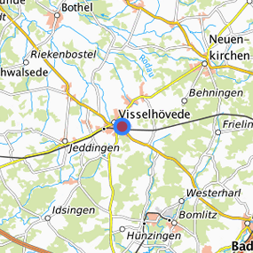
Celler Straße Ost
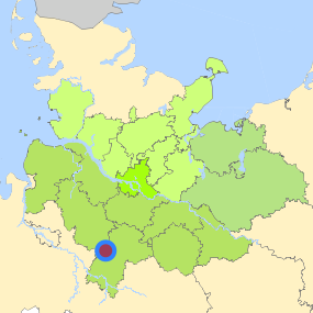
Municapility/city
Visselhövede
Parcel
Property size (m²)
1,738.61
Availability
immediately available
focus use
other usage
further use
other usage
Legal planning situation
Commercial space secured by planning permission
Yes
Building area according to land use plan
commercial building area
Existing planning law
§30 BauGB (qualified development plan)
Type and extent of building and land use
Specific type of structural use
GI
GE
Development situation
fully accessible
24-hour operation
Yes
possible site occupancy ratio
No information
possible floor area figure
No information
possible number of full floors
No information
possible height of building structures
No information
cubic index
No information
Exclusions/restrictions of land use
restrictions to mobilization
Not specified
Infrastructur of site
broadband availability (at least 50 MBit/s)
Not specified
quay edge
No
quay edge with sea-going vessel deep water
No
direct rail connection
No
electricity connection
Yes
gas connection
Yes
water connection
Yes
wastewater connection
Yes
Proprietary situation and marketing intention
proprietary situation
Public
Links to the parcel
Detailed information about commercial zone
Gross surface area (ha)
40.10
Sector focus
trade, maintenance and repair of motor vehicles
wholesale
Type of location of commercial estate
classic commercial estate
Transport accessibility
Motorway
A 27
17.1
km
Motorway
A 7
17.4
km
Motorway
A 1
33.8
km
Motorway
A 261
59.5
km
Motorway
A 352
60.4
km
Main road
B 440
0.5
km
Main road
B 71
11.3
km
International airport
Flughafen Bremen
61.5
km
International airport
Flughafen Hannover
65.4
km
International airport
Flughafen Hamburg
89.1
km
Regional airport
Cuxhaven
124.4
km
Regional airport
Flughafen Lübeck
136.8
km
Commercial airfield
Rotenburg (Wümme)
25.6
km
Commercial airfield
Hodenhagen
28.6
km
Commercial airfield
Weser-Wümme
32.2
km
Commercial airfield
Uelzen
70.1
km
Commercial airfield
Uetersen/Heist
103.1
km
Port
Seehafen FHH
72.4
km
Port
Binnenhafen Lüneburg
74.7
km
Port
Binnenhafen Uelzen
80.3
km
Port
Binnenhafen Geesthacht
86.1
km
Port
Seehafen Stade-Bützfleth
87.2
km
Rail freight traffic
Emons Spedition GmbH
77.7
km
Intermodal terminal
Soltau Logistics-Center
27.3
km
Intermodal terminal
Holborn Raffinerie (FHH, trimodal)
68.8
km
Intermodal terminal
Terminal Wallmann (FHH, trimodal)
71.5
km
Rail passenger transport
Visselhövede
2.1
km
Rail passenger transport
Walsrode
15.6
km
Rail passenger transport
Dorfmark
16.5
km
Rail passenger transport
Bad Fallingborstel
17.4
km
Rail passenger transport
Soltau
20.6
km
Availability of public transport
Limited available
Information about Visselhövede
GDP per capita (in €)
(district level)
64,013.00
Rate of unemployment (in %)
(district level)
3.80
Inhabitants of the municipality
10,000
Trade tax rate
380
Property tax B
416
Contact
Angela IlievskiStadt Visselhövede
Stadtmarketing und Wirtschaft
Marktplatz 2
27374 Visselhövede
Patrick Monsees
Landkreis Rotenburg/Wümme
Amt für Kreisentwicklung
Amtsallee 7
27432 Bremervörde
Contact
Angela IlievskiStadt Visselhövede
Stadtmarketing und Wirtschaft
Marktplatz 2
27374 Visselhövede
Patrick Monsees
Landkreis Rotenburg/Wümme
Amt für Kreisentwicklung
Amtsallee 7
27432 Bremervörde