GEFIS Gewerbeflächen-Informationssystem
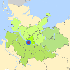
Stader Straße/ Waltershofer Straße (Cuxhavener Straße 98) at Hamburg, Freie und Hansestadt Hamburg


Legend
Availabilities
Immediately
short term (2 years)
medium term (2-5 years)
long-term (> 5 years)
optional area (bindingly reserved)
occupational pension plan
not available
Brief description
Description of the parcel
Stader Straße/ Waltershofer Straße
Municapility/city
Hamburg
Parcel
Property size (m²)
1,100
Availability
immediately available
focus use
other usage
further use
unavailable
Legal planning situation
Commercial space secured by planning permission
Yes
Building area according to land use plan
commercial building area
Existing planning law
§30 BauGB (qualified development plan)
Type and extent of building and land use
Specific type of structural use
GE
Development situation
fully accessible
24-hour operation
No
possible site occupancy ratio
No information
possible floor area figure
No information
possible number of full floors
No information
possible height of building structures
No information
cubic index
No information
Exclusions/restrictions of land use
restrictions to mobilization
Others
Infrastructur of site
broadband availability (at least 50 MBit/s)
Yes
quay edge
No
quay edge with sea-going vessel deep water
No
direct rail connection
Yes
electricity connection
Yes
gas connection
Not specified
water connection
Yes
wastewater connection
Yes
Proprietary situation and marketing intention
proprietary situation
Public
Detailed information about commercial zone
Gross surface area (ha)
11.49
Sector focus
other manufacturing sectors
crafts
Type of location of commercial estate
location for crafts and small-scale trades
Transport accessibility
Motorway
A 7
2.3
km
Motorway
A 253
6.8
km
Motorway
A 261
6.9
km
Motorway
A 1
9.1
km
Motorway
A 252
13.1
km
Motorway
A 255
15.0
km
Motorway
A 39
16.1
km
Motorway
A 25
16.2
km
Motorway
A 23
20.0
km
Motorway
A 26
20.8
km
Motorway
A 24
20.9
km
Main road
B 73
0.1
km
Main road
B 75
6.0
km
International airport
Flughafen Hamburg
25.2
km
International airport
Flughafen Bremen
99.5
km
International airport
Flughafen Hannover
126.1
km
Regional airport
Flughafen Lübeck
75.0
km
Regional airport
Cuxhaven
105.6
km
Regional airport
Schwerin-Parchim
141.5
km
Commercial airfield
Uetersen/Heist
36.5
km
Commercial airfield
Hartenholm
58.9
km
Commercial airfield
Rotenburg (Wümme)
60.4
km
Commercial airfield
Hungriger Wolf
72.9
km
Commercial airfield
Neumünster
74.2
km
Port
Seehafen FHH
5.6
km
Port
Binnenhafen Geesthacht
38.7
km
Port
Seehafen Stade-Bützfleth
42.7
km
Port
Binnenhafen Lüneburg
51.5
km
Port
Binnenhafen Lauenburg
54.5
km
Rail freight traffic
Emons Spedition GmbH
15.8
km
Rail freight traffic
Lübeck Nordlandkai (trimodal)
78.6
km
Rail freight traffic
Lübeck Konstinkai
80.0
km
Intermodal terminal
Holborn Raffinerie (FHH, trimodal)
3.8
km
Intermodal terminal
Hansaport Terminal (FHH, trimodal)
6.6
km
Intermodal terminal
Containerterminal Altenwerder (FHH, trimodal)
7.0
km
Rail passenger transport
Neuwiedenthal S
2.7
km
Rail passenger transport
Neugraben S
3.8
km
Rail passenger transport
Heimfeld S
4.2
km
Rail passenger transport
Harburg Rathaus S
5.5
km
Rail passenger transport
Fischbek S
6.0
km
Public transport
Hamburg Haake
0.2
km
Public transport
Hamburg Försterkamp
0.8
km
Public transport
Hamburg-Hausbruch
0.8
km
Public transport
Hamburg Zum Dubben
0.9
km
Availability of public transport
Not specified
Information about Hamburg
Inhabitants of the municipality
1,852,478
Trade tax rate
470
Property tax B
540
Contact
Stefan WieschebrockHamburg Invest
Bereichsleitung
Wexstr. 7
20355 Hamburg
Contact
Stefan WieschebrockHamburg Invest
Bereichsleitung
Wexstr. 7
20355 Hamburg